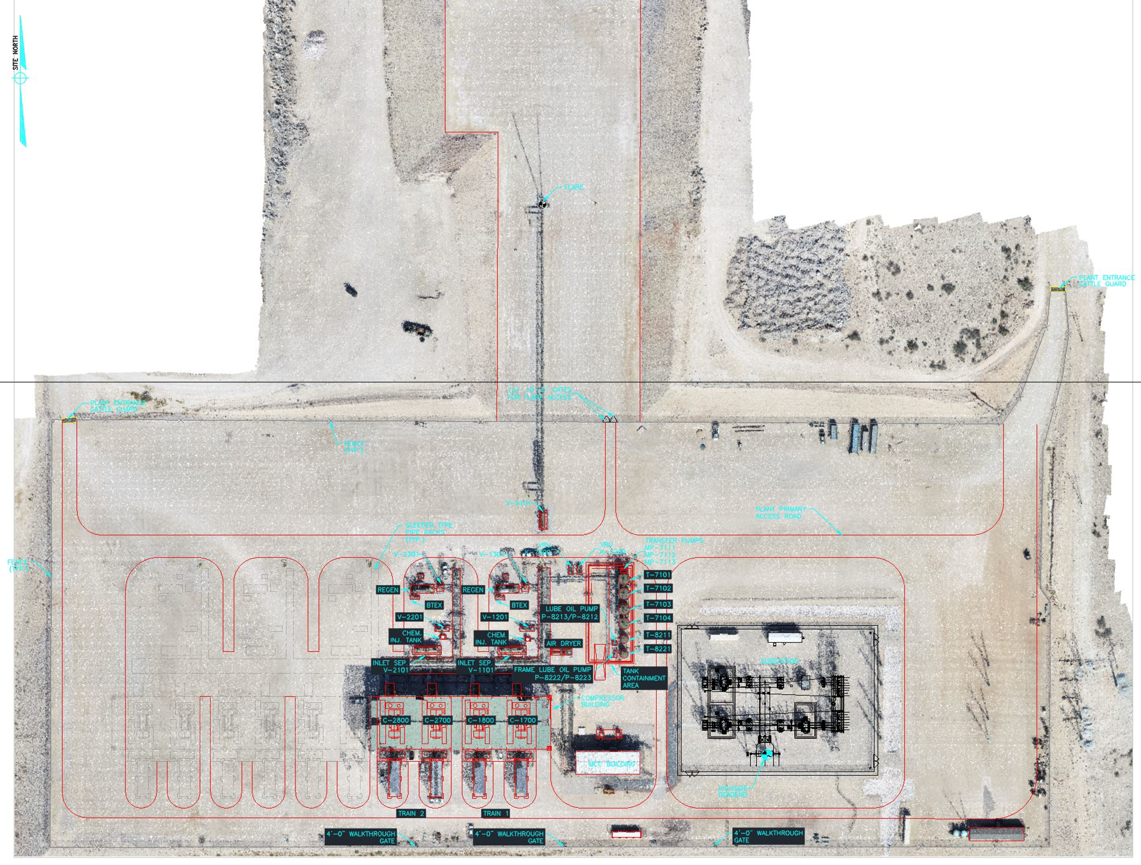
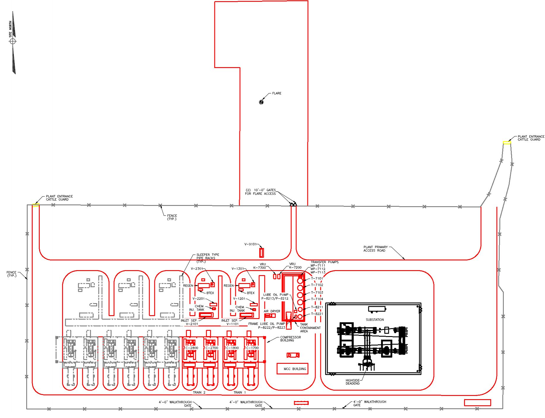
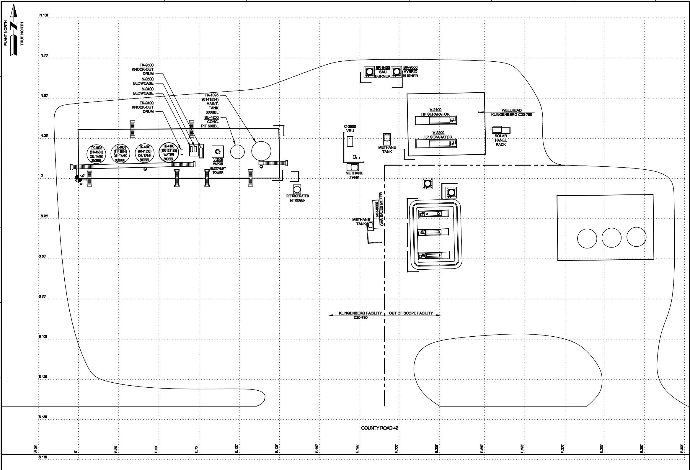
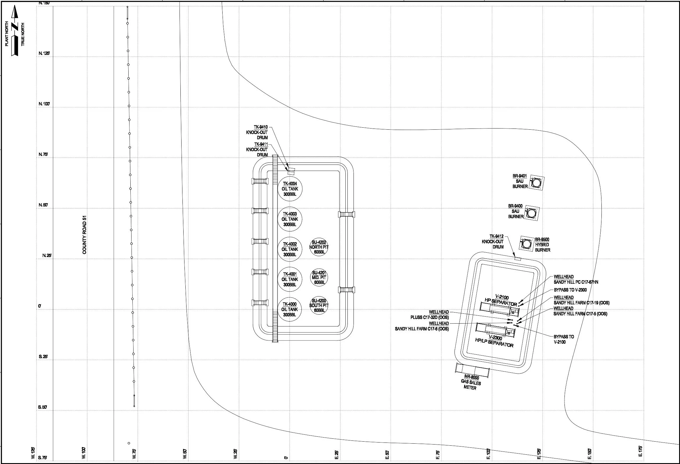
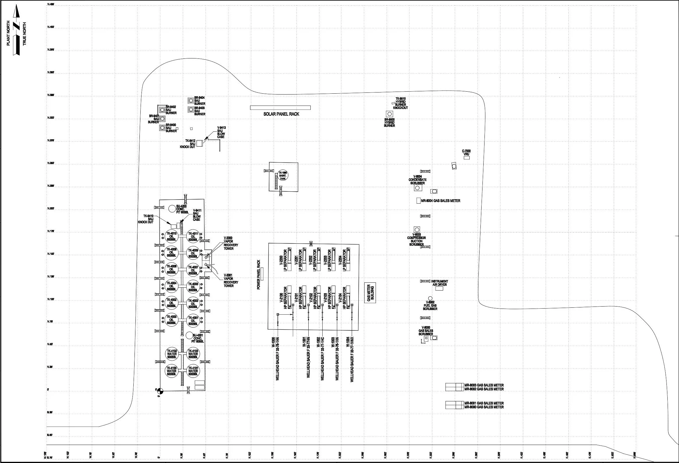
Facility Capture uses Drone Technology to quickly fly a site, take hundreds of photos, register the photos together to create a point cloud, then draw a Facility Plot Plan using that data.
Facility Capture specializes in the creation of plot plans, not only of commercial sites but also of oil and gas facilities. We have successfully flown and created hundreds of facility plot plans.
Drone Flights are a quick, easy, and accurate way to measure equipment on a site.
Facility Capture, LLC specializes in Drone Flights for Plot Plans and Project Timeline Tracking!